WA's Seasonal Shift: Seabreeze to Frontal
Quick summary
The Fremantle Doctor peaks in December and January, then weakens from February as ocean temperatures peak near 23°C and the land-sea differential narrows.
From May onwards, cold fronts tracking out of the Southern Ocean replace the sea breeze, bringing strong south-westerlies and long-period swell to WA's coast.
The how-to
Read this to understand the timing and mechanics of WA's seasonal wind and swell shift so you can plan sessions, gear, and safety margins through the transition months.
The wind change that reshapes WA's coast doesn't flip overnight - it unfolds across a four-month window from February to June, as two entirely different atmospheric systems trade dominance.
What drives summer is straightforward: land heats faster than ocean, creating a pressure gradient that pulls cool sea air inland each afternoon.
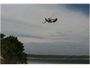
This is the Fremantle Doctor - a south-to-southwest sea breeze that kicks in between 10am and 3pm along the southern half of the west coast, reaching 15-25 knots most afternoons from November to January.
The Doctor is strongest in December and January, when inland temperatures regularly hit 40°C while the Indian Ocean sits near 20-21°C, producing the maximum thermal gradient.
By early February, sea surface temperatures are climbing toward their annual peak of around 22-23°C near Cottesloe, and that shrinking differential weakens the sea breeze with it.
February to March: the Doctor starts fading
Bunuru, the Noongar season covering February and March, is the hottest part of the year with the highest sea temperatures.
The land-sea temperature differential is still positive but smaller, so the Doctor arrives later, blows lighter, and drops off earlier than in peak summer.
Sea breeze days averaging 20-25 knots in January become 15-20 knot days by late February, and by March there are afternoons where the breeze barely fills in at all.
Hot easterlies - dry continental air blowing off the inland - become more frequent in March, pushing coastal temperatures above 38°C and blocking sea breeze development for days at a time.
March and April are also the most common months for ex-tropical cyclone remnants to reach Perth, producing periods of heavy rain and chaotic wind patterns along the west coast.
The transition window: April to May (Djeran)
The Noongar season of Djeran runs April to May: the land cools, nights get cold, dew appears in the mornings, and the sea breeze pattern becomes genuinely unreliable.
On some April days you'll still get a 20-knot Doctor from the south-southwest at 1pm, identical to January.
On others, the sea breeze won't arrive at all, replaced by a light variable northerly that shifts west as an approaching front begins to steepen the pressure gradient from the southwest.
The critical difference between the sea breeze and an approaching front is how the wind builds.
A sea breeze clocks south as the afternoon heats up, arrives at a fairly consistent strength, and dies at sunset as the land cools.
A pre-frontal northerly builds steadily for 12-18 hours, sometimes reaching gale force, before the front crosses and the wind slams southwest with a sharp temperature drop.
 Frontal kiting from April onwards is expert-only territory, with rapid wind shifts and onshore swell requiring solid self-rescue skills before launching.
Why WA's coast takes fronts hard
Southwest WA is the first landmass cold fronts encounter after crossing the Indian Ocean, with no terrain to slow them before they hit the coast.
These fronts form along the Southern Annular Mode's westerly wind belt - the Roaring Forties - which circles Antarctica and drives a near-continuous procession of low-pressure systems eastward through the south Indian Ocean.
In summer, the subtropical high sits far enough south to keep fronts clear of WA's populated coast.
From May, the high retreats northward, allowing fronts to track into southern and southwest WA, producing regular wind warnings across Cockburn Sound, Gage Roads, and the WA Mid Coast zones.
During a good winter, frontal passages arrive roughly every five to seven days through June and July, with south-westerly winds of 25-40 knots lasting 12-24 hours before conditions briefly ease ahead of the next system.
Swell: where it comes from and when it builds
The swell that defines WA's winter coast is generated by Southern Ocean storm systems tracking along the 40-50°S band, roughly 2,000-4,000 kilometres southwest of the coast.
At that fetch distance, the energy organises into long-period swell trains: wave periods of 12-18 seconds, arriving in clean sets well separated in time.
"A 2m swell at 16 seconds carries more energy than a 3m swell at 8 seconds - it's the period, not the height, that determines how hard WA's winter breaks."
Most people assume bigger swell means more power - but period is what actually determines wave energy.
A 2m swell at 16 seconds carries more water volume and wave force than a 3m swell at 8 seconds, which is why WA's winter surf breaks with disproportionate force relative to the measured height.
The southwest corner of WA from Margaret River to Cape Naturaliste receives the most consistent winter swell exposure - 3-5m swells with 14-18 second periods for months at a time, occasionally exceeding 6m at exposed breaks like Cowaramup Bombora and The Right.
Perth's metro coast is partially sheltered by Rottnest Island, which blocks swell from the northwest and reduces wave height inside the island's swell shadow.
Heavy winter swells still reach Trigg, Scarborough, and Cottesloe, but consistently at lower heights than spots north of Rottnest or south toward Fremantle.
The best surfing at Trigg Beach is typically during winter, most often in June, when consistent clean groundswell from the southwest pushes through the island gap.
Water temperature: slower than you'd expect
WA sea surface temperatures peak in late February near 22-23°C and fall steadily from March through to their annual minimum around September, reaching 16-18°C in the Perth metro zone.
That's a 5-6°C drop across six months - not dramatic compared to east-coast waters, but enough to change what you wear and how long you stay comfortable in the water.
The Leeuwin Current plays a key role: this year-round southward-flowing current strengthens through autumn and winter from April to July, driven by a large ocean pressure gradient between the tropics and the south.
It pushes warmer tropical surface water down the coast, keeping WA sea temperatures higher than equivalent latitudes elsewhere in Australia.
It's why the WA coast rarely drops below 16°C even in deepest winter, while South Australian and Victorian coasts at similar latitudes regularly reach 12-14°C.
 Gear through the transition
A 3mm spring suit handles the metro coast from November to March, while water temperature stays above 20°C and air temperature keeps sessions comfortable.
From April, a 3/2mm full steamer is worth having: water is still warmish, but the wind chill from frontal south-westerlies drops the effective temperature fast after you come in.
By June and July, a 4/3mm or 5/4mm wetsuit with booties and gloves is standard for kitesurfers and surfers spending extended time in the water at exposed spots.
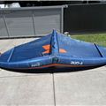
Kite sizing shifts considerably: summer's 12-14m for a 15-20 knot sea breeze needs a different strategy in winter, when frontal winds arrive gusty and can spike from 20 to 40 knots as the front passes.
Flying a smaller kite in frontal conditions is always safer than one you can't depower quickly - the sea breeze's reliable strength window disappears entirely when a front is in play.
Planning sessions during the transition
The March to May window is where forecasting knowledge pays off more than any other time of year.
A day that looks like a reliable Doctor - sunny, inland temperature above 30°C, light morning easterly - can turn very different if a trough nearby suppresses sea breeze development entirely.
The most useful tool is the synoptic chart: a trough or approaching front shows as a zone of low pressure from the southwest, and tightening isobars tell you how quickly the gradient is building.
Check the our Wind Forecasts and Live Wind before launching - we cover the entire WA coast, Cockburn Sound, Gage Roads, and Rottnest, updated many times daily with expected wind strength, direction, and sea state.
Track the local wind model and marine forecast together on the Seabreeze WA wind forecast, which lets you compare the sea breeze signal against incoming frontal patterns across the metro and south-west coast.
One specific pattern to watch for in autumn: a pre-frontal northerly will often collapse to dead calm for 30-60 minutes before the southwesterly fills in hard.
That calm window is not conditions improving - it's the front arriving, and the southwest wind follows within minutes.
What the shift means for different water users
For kiters and windsurfers, the Doctor's departure means sessions need active safety planning rather than the casual afternoon rhythm of summer.
For surfers, the shift is welcome: consistent long-period groundswell, light or offshore easterly morning winds, and uncrowded lineups replace the blown-out summer afternoons chewed up by the Doctor.
For boaties and anglers, the increased frontal activity from May means careful monitoring of the BOM Marine Forecast before every offshore run, with many smaller trailer boats holding off until a high-pressure window settles conditions.
As the Leeuwin Current strengthens through April and May, it temporarily pushes pelagic species like mahi-mahi further south, while bottom dwellers like dhufish and baldchin groper remain on the reefs - but the swell makes accessing those reefs from a small boat significantly harder.
Common questions
Does the sea breeze ever appear in winter?
Sometimes in May, on a warm pre-frontal afternoon when inland temperatures are above 25°C, a weak southwesterly develops by 2pm - but it's short-lived and typically dies before sunset.
Which wetsuit for Perth metro in June?
A 3/2mm full steamer works for short sessions on calmer days, but a 4/3mm is more comfortable for anything over an hour when the southerly wind chill is running.
Is winter swell consistent or does it gap out?
More consistent than most east-coast spots - the Roaring Forties produce near-continuous storm activity through June and July, with swell gaps typically limited to 2-3 days maximum between significant events.
What's the best signal that summer is truly over?
The first cold front that drops the afternoon temperature by 10°C or more while you're on the water - that shift from a warm northerly to a cold southwest in under an hour is the clearest sign the season has turned.

Australian Kitesurfing Shops & Schools
Need to find a kiteboarding store or kiteboarding school for lessons - all stores listed here