QLD Floods: Two Dead Near Kilkivan
In short:
Two tourists were found dead in a submerged vehicle near Kilkivan in Queensland's Wide Bay-Burnett region on 12 March 2026, following intense rainfall across the catchment.
The Burnett River at Bundaberg peaked at 7.4 metres, flooding around 240 homes, while the Katherine River in the NT reached 19.2 metres, the second-highest level on record, the 1998 flood peaked at 20.39 metres.
What's next?
Floodwaters are receding but road damage and clean-up will continue for weeks, check the Seabreeze warnings map for any active alerts near you.
Two tourists were found dead inside a submerged vehicle near Kilkivan in Queensland's Wide Bay-Burnett region on 12 March 2026, as intense rainfall driven by a slow-moving monsoon trough brought catastrophic flooding to parts of south-east Queensland and the Northern Territory. The fatalities are among the most tragic outcomes of a flood event that has cut roads, inundated hundreds of homes, and triggered evacuations across multiple regions since early March.
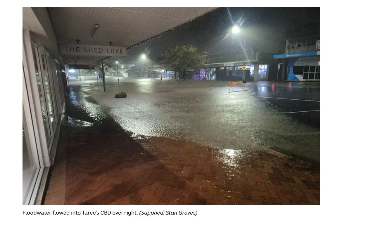
In Bundaberg, the Burnett River peaked at 7.4 metres, a major flood level, inundating around 240 homes and affecting approximately 120 businesses. SES crews conducted door-to-door welfare checks and assisted residents with evacuation and sandbagging over several days as the river rose steadily from rainfall upstream. The peak followed heavy and sustained falls across the Wide Bay and Burnett catchments between roughly 7 and 10 March, with daily totals exceeding 100 millimetres at multiple gauges during the most intense period.
The Northern Territory copped it harder. The Katherine River reached 19.2 metres, the second-highest level on record, the 1998 flood peaked at 20.39 metres, with the peak arriving before midnight on 7 March after a monsoon trough pushed significant moisture across the Top End. Widespread road closures affected the Stuart Highway and surrounding routes, isolating communities and cutting supply lines for several days. For a river system that carries enormous volumes during major events, a 19.2-metre peak is a serious benchmark; the 1998 flood it matched caused extensive damage to Katherine township and remains the reference event for the region's flood planning.
The monsoon trough responsible for this event was one of several embedded tropical lows that tracked across northern Australia through late February and early March. These systems are difficult to predict more than 72 hours in advance once they interact with the complex topography and moisture fields of northern Queensland and the NT. Emergency management agencies in both states activated their incident response structures ahead of the worst impacts, with flood watches and warnings issued as conditions developed.
"A 19.2-metre Katherine River hadn't been seen since 1998, the floodwaters that arrived in March 2026 matched one of the region's most significant historical benchmarks in a single night."
The road toll underlines a consistent warning. The two deaths near Kilkivan reinforce what emergency services repeat every wet season: do not drive through floodwater. The forces in moving water are routinely underestimated, 15 centimetres of fast-moving water can knock a person off their feet, and as little as 30 to 60 centimetres of rushing water can sweep away most passenger vehicles. Floodwater conceals washed-out road surfaces, submerged culverts, and debris. At night, the depth and speed of water across a road is impossible to judge from inside a vehicle. Queensland Fire and Emergency Services issued repeated warnings during this event urging drivers to turn around rather than attempt crossings.
Recovery operations across the Wide Bay-Burnett are now underway. Flooded homes face the slow work of removing water-damaged contents, drying out structure, and assessing what can be salvaged before mould sets in, a process that takes weeks under the best conditions. The Queensland Government's disaster assistance program provides support grants for eligible residents and primary producers in declared disaster areas; anyone affected should contact the Queensland Reconstruction Authority to check their eligibility.
With the monsoon trough expected to retreat northward through the remainder of March, the risk of further major inland-penetrating events diminishes as autumn progresses. Isolated heavy rainfall events associated with tropical moisture can still affect Queensland's coast and ranges through April. Check the Seabreeze warnings map to see active warnings in your area, the maps make it easy to view what's active near you.