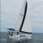
Australin coastal charts

> 10 years ago
Reply
Register to post, see what you've read, and subscribe to topics.
cisco
cisco
QLD
12365 posts
QLD, 12365 posts
3 Jul 2013 10:42pm
Thanks for that post HaveFun. I am interested to hear more of your experiences with Quick Charts and Memory Map.

I quizzed the electronics/navigation guy at Whitworths Woolangabba about Quick Charts and he seemed to indicate that was only of use if you were online on the net to validate each time you used it.

That is hardly any use when you are out at sea and I find it hard to believe the software vendors would build that into the program.

Ramona speaks the praises of Seaclear (which he has been using for a loooong time) but I am daunted by the task of indexing each chart into the program. Maybe I am not reading him right. I have had a play with Seaclear on the home PC with a couple of raster charts (not good quality reproductions) and concluded that was not good enough for reliable navigation.

What I am looking for is a Nav program that will recognize charts (be they raster or vector) and automatically index and add them into the data base.

Is there such a thing, be it free or at a reasonable cost?? Ie <$500??
HaveFun
HaveFun
NSW
201 posts
NSW, 201 posts
4 Jul 2013 7:58am
You can have a look at the Quickcharts when we catch up in Bundaberg. Quick charts only needs to be authenticated once (not every time you use it) and can be done off line as well as online. memory map allows for charts to be imported so I assume what the the distributers of Quickcharts has done is use the import function to load up the raster charts. I have only purchased the East Coast set up that covers Tassie to Queensland. There is a West Coast package available for those only interested in SA, WA and NT. The main shortcoming is the lack of sufficient instructions for someone using it for sailing. For someone selling their product through boating supply retailers this is disappointing. A bit of effort to get someone to write instructions applicable for nav planning for sailing shouldn't be too hard. Having said that, once you hit upon a way of getting it to produce what you want it is very useful. Having used it for planning I will be interested to see how it performs in the nav mode at sea. I have a GPS antenna that plugs into my old pc so I don't expect a problem.
frant
frant
VIC
1230 posts
VIC, 1230 posts
4 Jul 2013 9:32am
I have MaxSea with world C-maps charts and PC Plotter (a Navionics chart PC chartplotter) and Navionics Gold charts in Raymarine plotter. I would not go anywhere without the latest Navionics charts (Vector charts). My experience is that only a vector chart will give you the zoom in required to see navigational hazards. eg The rhumb line route from Galapagos to Hiva Oa in French Marquesas is 2900 nautical mile. 150 nautical mile before Hiva Oa is a volcano arising from the sea bed 3000 metres below. This particular "island" however falls 10 metres short of the surface. If you zoom close enough on the chart for 10 metre contours to be visible you can see this hazard. We kept 20 miles clear as I hate to think of the current and rogue waves that could occur close by. Same situation with Bass Strait Islands and surrounding rocks.
I was chatting to a cartographer about best electronic charts recently. This chap had just finished a contract with Navionics and was currently on board a Naval Survey vessel updating the Admiralty surveys. The Naval survey vessel uses Navionics charts on the bridge for their own navigation as the commercial chart updates are released sooner and are more accurate.
Ramona
Ramona
NSW
7754 posts
NSW, 7754 posts
4 Jul 2013 9:40am
The advantage of Seaclear is there is a very active worldwide forum for support. The limitation is the quality of charts which is basically down to the Admiralty charts. The Admiralty charts of course are what all these other charting programmes use under license anyway. So under normal circumstances the chart quality is just the same and is only limited by what the operator chooses to load. What Cisco is probably referring to with chart loading problems is the fact that with Seaclear you have to calibrate your charts and then set up a chart flow so that at sea the charts self load as you proceed up and down the coast.
dmatz
dmatz
SA
9 posts
SA, 9 posts
4 Jul 2013 10:53am
I have been using memory map for three or four years now and yes the charts only have to be downloaded from the mapshop once. I purchased the licence for the west coast package. I agree with Havefun it is a bit clunky for route planning but works OK just not as easy as it could be. I have an
old toughbook with a USB GPS puck that I use on the boat and have also found it very useful for route planning before we leave , we also have an old simrad plotter running at the same time feeding course info back to a repeater in the cockpit, the toughbook stays in the chart table and is only used if we are off course or near hazards much easier to look at then the small screen on the plotter. It works well the only calibration is to enter the Datum
Shift as printed on the chart into the chart properties window.
cisco
cisco
QLD
12365 posts
QLD, 12365 posts
4 Jul 2013 2:02pm
Ramona said..

What Cisco is probably referring to with chart loading problems is the fact that with Seaclear you have to calibrate your charts and then set up a chart flow so that at sea the charts self load as you proceed up and down the coast.


That is exactly it. I am sure once done it would work beautifully. It is just getting that done correctly and completely that scares me.

Also I don't think you have yet revealed where or how you scource charts at a reasonable price.

Would Seaclear run Quick Charts? They are reasonably priced.

I have an old lap top running Windows 98 SE on which I have installed a pirated version (Russian I think) of CMap4 for the whole world. As Frant says, the zoom capabilities of vector charts is way above par of anything else. The problem is that it is quite old now and I have so far been unable to get it to recognize a signal from a puck GPS. It is to do with a 4800 Baud rate apparently.

Previously mentioned I did a trip from Bundy to Brisbane on a friend's 40 ft Flemming Moreton bay Cruiser using the TMQ Nav and Chart Program. It is quite excellent with zoom and detail and I think cost circa $1,000.

A PC based nav program is invalueable for night time in close waters. For most other situations I am more than happy with paper charts and a standard GPS receiver.


LooseChange
LooseChange
NSW
2140 posts
NSW, 2140 posts
4 Jul 2013 7:14pm
cisco said..

Would Seaclear run Quick Charts? They are reasonably priced.


Nope, don't think so, Quick Charts is locked to Memory Map and no conversion available in Sea Clear.

cisco said..
I have an old lap top running Windows 98 SE on which I have installed a pirated version (Russian I think) of CMap4 for the whole world. As Frant says, the zoom capabilities of vector charts is way above par of anything else. The problem is that it is quite old now and I have so far been unable to get it to recognize a signal from a puck GPS. It is to do with a 4800 Baud rate apparently.


Baud rate for the ports is set via device manager in control panel (I think, it's been soooo long since I've seen a 98SE machine)
Settings will be 4800, 8, none, 1, none


I downloaded Memory Map last night and as it comes with a base world map you can get some idea of what it looks like and how it functions.

All in all I would not pay money for the program after comparing it to Sea Clear, Ozi Explorer or Open CPN, all of which I have installed as well.
Getting charts can and is problematic, the only charts available for both Sea Clear and Ozi Explorer are the ones that you yourself have acquired, scanned and then calibrated. CM93v2 charts will run in Open CPN (very nicely too may I add) as do BSB and KAP charts (also nicely) but of course are getting hard to come by (at the right price).
HaveFun
HaveFun
NSW
201 posts
NSW, 201 posts
5 Jul 2013 11:15pm
DMatz, can you explain the comment "the only calibration ,,,is to enter the shift on the chart into the ,,," I am assuming there is no calibration required when using the raster charts with the memory map program. If there is then lease let me know because I haven;t seen any reference to that. Or are you referring to your plotter?
dmatz
dmatz
SA
9 posts
SA, 9 posts
8 Jul 2013 12:20pm
HaveFun said..
DMatz, can you explain the comment "the only calibration ,,,is to enter the shift on the chart into the ,,," I am assuming there is no calibration required when using the raster charts with the memory map program. If there is then lease let me know because I haven;t seen any reference to that. Or are you referring to your plotter?


Datum Shift is printed on some but not all charts it is the correction of the GPS Co-ordinates to agree with those printed on the chart.
In memory map use the dropdown menu MAP then EDIT MAP PROPERTIES and you will see the WGS84 Datum shift.
Hope this helps.
Ramona
Ramona
NSW
7754 posts
NSW, 7754 posts
9 Jul 2013 9:25am
cisco said..


I have an old lap top running Windows 98 SE on which I have installed a pirated version (Russian I think) of CMap4 for the whole world. As Frant says, the zoom capabilities of vector charts is way above par of anything else. The problem is that it is quite old now and I have so far been unable to get it to recognize a signal from a puck GPS. It is to do with a 4800 Baud rate apparently.


Windows 98 SE is more than capable of handling Seaclear. The important requirement is a large screen with high pixel count otherwise you may as well use a plotter. The Baud rate depends on your GPS puck. It's usually 4800 but can be 9600. Its selected in the properties box in Seaclear. In your case check whether you have the drivers loaded for your GPS puck. If anyone is about to update their GPS puck ensure they buy a Sirf 4 chip version and not a Sirf 3. The new one is twice as sensitive and operates through a steel roof where as the old one and hand held Garmins etc will not. Naturally they are twice the price.
I mentioned previously the pro boats here use Seaclear or TMQ, about 50:50. There is no difference in performance and its all down to the charts you load.
My homeport chart is a digital MSB chart downloaded from their webpage as a PDF file for free or you can pay for a paper version. My off shore charts are all digital admiralty. These are readily available but expensive or you can trade. The Msb charts are more accurate than the admiralty! If you scan paper charts the error can be eliminated when you calibrate. The error is listed in the details in the top LH corner for conversion to electronic charting, I have no idea why there should be an error, its usually only small and I just calibrate my charts as normal.
My unit on my yacht is a 16 inch laptop but have been thinking about an update. If I was starting again now I would go straight to a 24 inch screen, mini computer running 98SE. Retain the trackball but also use an air mouse from the cockpit.
LooseChange
LooseChange
NSW
2140 posts
NSW, 2140 posts
9 Jul 2013 10:02am
Backward thinking is not to be encouraged. While people may have copies of old operating systems eg. Win 98 SE, Win ME laying around, it is now more difficult to find the hardware to support these old OS's. If you have an old Win 98 vintage laptop, by all means use it till it dies and then turf it.

Laptops are now so cheap that you can have the best of everything for very little money. Sea Clear, Ozi Explorer, open CPN and Memory Map all run in Win 7 & 8 ( I don't like Win 8).

Ultimately it's all down to the maps, what you can afford, scrounge or or even beg borrow or steal. CM93 is now getting a bit old for openCPN but still valid and if you want to scan your own charts and calibrate them to .KAP format then it will run those too. Memory Map runs it's own format with no scanning or conversion available. Both Sea Clear and Ozi Explorer run on user created maps, that is maps you yourself have scanned and calibrated using the attendant calibration program, Sea Clear will also support the .KAP format if you have those.
dmatz
dmatz
SA
9 posts
SA, 9 posts
9 Jul 2013 2:33pm
I have have just downloaded Seaclear and had a play and yes it does seem to be supperior to Memory Map, a lot more features
and looks easier to plan routes etc.
I think I will be able to convert Quickcharts to use with seaclear!
I will keep you posted!
claverton
claverton
NSW
165 posts
NSW, 165 posts
9 Jul 2013 5:54pm
Intel's recently released Haswell chip should provide substantially lower power use which will have obvious benefits offshore ...

www.independent.co.uk/life-style/gadgets-and-tech/news/better-battery-for-your-buck-intel-s-new-haswell-chips-focus-on-low-power-consumption-rather-than-8642540.html
scruzin
scruzin
SA
562 posts
SA, 562 posts
10 Jul 2013 12:02am
If anyone is interested in making your own OpenCPN-compatible charts from images (either scanned from a paper chart or converted from another electronic format, such as PDF), check out this simple web app I wrote to make the overlay/alignment process a little easier:

http://www.nobletech.com/maps/chartlayer.html

I also wrote a blog post which describes how to use it:

blog.arribasail.com/2013/06/tech-making-charts-for-use-with-opencpn.html

You'll also need to download the free imgkap program.


Ramona
Ramona
NSW
7754 posts
NSW, 7754 posts
10 Jul 2013 8:47am
LooseChange said..

Backward thinking is not to be encouraged. While people may have copies of old operating systems eg. Win 98 SE, Win ME laying around, it is now more difficult to find the hardware to support these old OS's. If you have an old Win 98 vintage laptop, by all means use it till it dies and then turf it.

Laptops are now so cheap that you can have the best of everything for very little money. Sea Clear, Ozi Explorer, open CPN and Memory Map all run in Win 7 & 8 ( I don't like Win 8).

.


I generally agree with this but if your building a low power 12v system that normally uses Linux then the Win 98 SE is a better choice. That's low power in current draw not performance. Still buy them new and cheap, stable and trouble free. Have not tried Win 8, Win 7 and XP can have trouble with Jumping Mouse Syndrome with some pucks. There are work rounds, Google will supply a few million ways around it but I found the only real way to solve the problem is buy a new puck. The Sirf chip versions don't seem to have this problem. If your ship board computer is for navigation and communication then there is very little hardware required. My system is Xp which is pretty stable. My home computers are win 7, bit flakey out of the box for boat use.

LooseChange
LooseChange
NSW
2140 posts
NSW, 2140 posts
10 Jul 2013 11:37am
My Point was that if you have an old copy, of say, Win 98 SE laying around you will have trouble as new hardware these days is not backward compatible with old operating systems. Somewhere in the future at some point you will have to upgrade to the new operating systems, why not do it now if contemplating a lappy based nav system.

If you have an old lappy laying around and you have Linux on it why on earth would anyone contemplate reverting back to Window$, assuming of course you have a nav program that runs under Linux without resorting to using Wine.
dmatz
dmatz
SA
9 posts
SA, 9 posts
10 Jul 2013 2:35pm
scruzin said..
If anyone is interested in making your own OpenCPN-compatible charts from images (either scanned from a paper chart or converted from another electronic format, such as PDF), check out this simple web app I wrote to make the overlay/alignment process a little easier:http://www.nobletech.com/maps/chartlayer.html

I also wrote a blog post which describes how to use it:blog.arribasail.com/2013/06/tech-making-charts-for-use-with-opencpn.html

You'll also need to download the free imgkap program.


Hi Scruzin, will your app work with .XPS Document
scruzin
scruzin
SA
562 posts
SA, 562 posts
12 Jul 2013 11:59am
Hi dmatz

No both my ChartLayer and imgkap (which you also need) only work with image formats, such as png or jpg.
Ramona
Ramona
NSW
7754 posts
NSW, 7754 posts
17 Jul 2013 9:52am
Item of interest for people that use google earth for navigation. I know its not local. There is also the chance if your near any defence installations you may not get the whole picture!

www.bbc.co.uk/news/uk-scotland-glasgow-west-23331456
cisco
cisco
QLD
12365 posts
QLD, 12365 posts
18 Jul 2013 12:28am
Met up with Have Fun yesterday here in Bundaberg and he showed me his smart phone with the Navionics App installed which costs the princely sum of $15.

Unbelievable. Why would anybody ever again buy a Garmin hand held??

He also showed me Quick Charts on his laptop and as he mentioned previously, the program does not come with much of a help file or instructions. However I think with some practice and experimenting one could learn how to use the program reasonably quickly and by way of forums like this one tips and tricks will emerge.

The quality of the raster charts is very good and the price quite reasonable. I think it is a good tool for passage planning at least, with printable screen dumps.
dmatz
dmatz
SA
9 posts
SA, 9 posts
18 Jul 2013 12:40pm
dmatz said..
I have have just downloaded Seaclear and had a play and yes it does seem to be supperior to Memory Map, a lot more features

and looks easier to plan routes etc.

I think I will be able to convert Quickcharts to use with seaclear!

I will keep you posted!


I was able to convert a chart from quickcharts to use in Seaclear by printing to a XPS document and then using an online
converter to change to a .png file and then calibrate and convert in Mapcal. The quality was not great and to much mucking around
for me so i will be sticking with Memory Map for now as Cisco said the quality of the charts is very good.
Please Register, or first...
Topics Subscribe Reply

Return To Classic site 😭
Or... let us know if a problem, so we can tweak! 😅