NSW Coast: Tasman Low Brings Unsettled Week

In short
A strong high in the southern Tasman Sea is directing persistent onshore easterlies across NSW coastal waters, with a coastal trough expected to deepen into a Tasman Low by mid-week, extending unsettled conditions from the Hunter coast down to Sydney.
Southerly swell is running at 1-2 metres inshore and 2-3 metres offshore, with wind gusts potentially 40 per cent stronger than forecast - bar crossings, exposed headlands and offshore runs all need reassessment before you leave the ramp.
What to watch
The coastal trough deepening into a Tasman Low is the key development - once it forms, winds shift south and conditions deteriorate further across the central and south coast; track the BOM forecast for when the shift hits your region.
A strong high pressure system sitting over the southern Tasman Sea is the story driving NSW marine weather this week.
Rather than clearing the coast as highs typically do, this system is drifting east toward New Zealand and feeding a persistent onshore easterly airstream directly into NSW coastal waters, according to the Bureau of Meteorology forecast issued at 4:00am EST on Monday 18 May 2026.
The setup: high in the Tasman, low developing to the north
The synoptic driver here is a blocking high - a slow-moving high pressure cell that stalls rather than tracking east, holding onshore flow in place for multiple days.
A coastal trough is expected to develop along the north NSW coast early this week before deepening into a Tasman Low, a low-pressure system that forms in the Tasman Sea and draws strong, often southerly winds against the coast.
Tasman Lows are well-known disruptors for eastern Australian coastal communities - they sit just offshore and can sustain hazardous swell and heavy rain for several days before dissipating.
For NSW boaters and fishers, the combined effect means two distinct phases: onshore easterlies now, shifting to stronger southerlies and elevated swell as the low deepens mid-week.

What the numbers look like at the coast
Southerly swell is currently running at 1-2 metres inshore and 2-3 metres offshore across central NSW waters, with those figures likely to build as the coastal trough organises.
The Hunter coast is also dealing with the aftermath of a cold front that moved through coastal waters over the weekend, leaving strong to gale-force west to southwesterly winds in its wake.
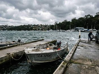
Bar crossings need a hard look before heading out - BOM notes wind gusts can be 40 per cent stronger than the forecast average, and maximum wave heights can reach twice the forecast height in localised sets.
Rock fishing conditions along exposed headlands from Sydney north to Newcastle are hazardous across the period, with surf conditions described as large and powerful during the morning hours.
"Wind gusts can be 40 per cent stronger than the forecast, and stronger still in squalls and thunderstorms, with maximum waves able to be twice the forecast height."
That caveat in the BOM marine forecast is worth reading twice before committing to an offshore run or a bar crossing this week.
Where this fits the bigger winter picture
This disruption arrives against a background of an unusually warm Tasman Sea.
Sea surface temperatures off NSW are currently running 2-3°C above average, with eastern Tasmanian waters up to 3°C above long-term means, according to Bureau of Meteorology climate data.
Warmer Tasman Sea temperatures add energy to weather systems and increase atmospheric moisture, which means events like developing Tasman Lows can deliver heavier rainfall and stronger associated gusts than the same system in a cooler-than-average sea state.
The ENSO background adds another layer. The El Nino-Southern Oscillation is currently neutral, but BOM modelling shows a transition to El Nino is likely during winter 2026, with international models including NOAA placing the probability at 82 per cent for the May-July period.
El Nino winters typically mean below-average rainfall for southeast Queensland, eastern NSW, most of Victoria and south-east South Australia - drier, clearer weather overall, but with a tendency for sharper, more defined cold fronts when they do arrive.
What this means for your sessions this week
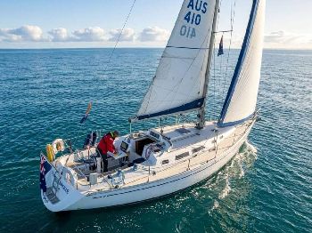
Offshore fishing from Sydney Harbour and Broken Bay ports looks marginal Monday and tight by Tuesday - the 2-3m offshore swell makes for an uncomfortable run and limits access to reef systems east of the 5nm mark.
Estuary options improve the picture notablely: the Georges River, Hawkesbury and Pittwater systems are sheltered from the dominant swell direction, and the onshore wind pull is bringing bait schools into the shallower bay reaches - flathead, bream and whiting are likely beneficiaries.
Surf fishers working exposed ocean beaches from Cronulla north should find elevated swell building the gutters - tailor and salmon will key into the churned-up wash zones, but launching and retrieval on sandy bars carries heightened risk when swell is building through the day.
Kayak fishers and small trailer-boat operators are best served staying inside the heads or in protected bays entirely until the coastal trough dissipates, which models currently show happening toward the weekend.
South coast: additional exposure through mid-week
The Illawarra coast from Port Hacking to Ulladulla faces a crossed swell pattern this week.
Residual southerly swell from the passing front combines with the building easterly sea state, creating choppier, more confused conditions than the swell heights alone would suggest.
Batemans Bay to Eden is seeing southerly swell in the 1.5-2.5m range with similar offshore amplification, and the bar at Ulladulla warrants extra caution given the swell direction aligns poorly with the bar entrance in southerly runs.
Crew planning weekend trips to south coast reefs - popular with Sydney snapper and blue-eye boats during winter - should watch the Friday-Saturday window carefully and have a 24-hour abort option in their planning.
Planning your week: what to watch
The key pivot is when the coastal trough on the north coast deepens into a defined Tasman Low - once that happens, winds along the central coast shift south and conditions tighten across the Sydney to Wollongong corridor.
Current modelling suggests mid-week as the likely timing for that development, with conditions gradually easing toward the weekend as the low tracks east and loses coherence.
A brief westerly window on Saturday morning, common in the wake of Tasman Lows as they depart, may offer a short offshore opportunity for boats willing to get out early - but confirm that timing with the weekend forecast before committing.
Track the developing pattern through the Seabreeze NSW warnings page for real-time updates to marine forecasts as the Tasman Low organises.