yoyo said...
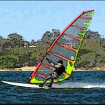
When gps were first used for speedsailing the Dutch guys had to use 2 second periods for the max speed because the 1 sec was way to spiky on their Garmins Gekos. After noticing that my own Garmin speeds seemed to come in discrete steps I decided to do some tests myself and found that the trackpoints that the software showed was rounded up to the nearest 2.4m N-S and 1.85m E-W. After emailing and discussing with Manfred ****hs (GPS-Speed) Mal Wright (Realspeed) and Yann (GPS Action Replay ) it was clear that it was and issue with garmin rounding up the data it stored in their log and not the software. After many emails and phone calls to Garmin and several denials finally a tecky there confirmed that is exactly what Garmin do and they had no intention of changing as most user didn't need the accuracy we required.. although there were some models that stored the full data like the Edge which was promoted as a cycling unit so had similar requirement to speedsailing (speeds and distances).
Indeed - wasn't it sailquik who first observed it, and gave it the name "grid effect"?
Of course there are other GPS's that dont suffer this problem, but the Navi's are interesting in particular, as the company decided that the *small* speedsailing market was big enough to justify spending some time/money on (either directly or inderectly through Tom Chalko) -> as a reuslt, most of us here use Navi's.
Whilst this is not a true walking test it does show the differences in errors. Yesterday my gps was stationary for some time. For 12 minutes it had exactly zero movement. Yet the track point data says it moved 170m over those 720 seconds (and this was with the full, non rounded trackpoint 10X more accurate than the Etrex/foretrex etc). ~ 24cm error average each second. Meanwhile the doppler data was only 27m movement for the same time period or only 3.75cm error for each second recorded.
In the case of your walk. it probably took you about 3 hours. The accumulated error could easily be over 2 km if each measurement is 20cm more inaccurate than doppler.
In the image below the trackpoint speed error is black whilst the the green one is doppler.
This technicque is one of the many techniques that the tech-team has used to test the various GPS's. Another would be to find a straight strech of road, then with say 10 GPS' sitting on the dashboard -> drive that road, then compare results between each GPS. Or you can sit those same 10 GPS's on in a open field for 72 hrs, finally comparing results -> this should show some of the atmospheric effects that can occur.