Cyclone watch
Looks like we have the potential for some heavy weather coming over the next week.
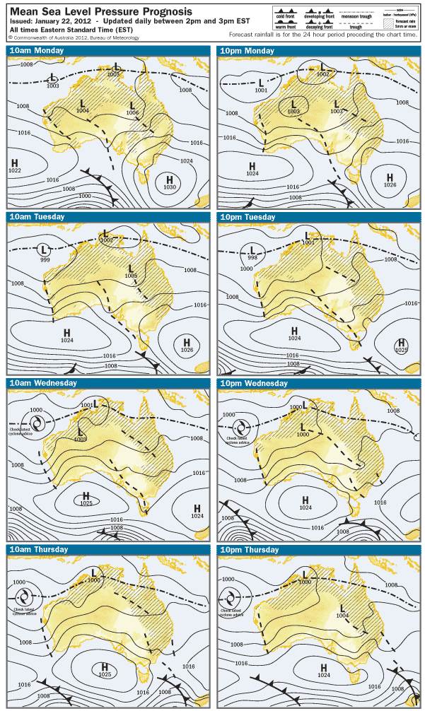
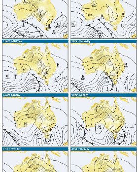
This is what you get when you pay the BOM for your weather forecasts:
Monday
Low. A system may be developing well north of Western Australia near the monsoon trough.
Also, a weak system may be located near the Top End.
Tuesday
Moderate. A strengthening system may be well north of the west Pilbara coast, moving west-southwest.
Also, a strengthening system may be located near the Top End, moving west-southwest.
Wednesday
High. A strengthening system is likely to be north of the NW Cape region, moving west-southwest.
Also, a strengthening system may be located near the JB Gulf and Timor Sea, moving west-southwest.
Thursday
High. A strengthening system will likely be far northwest of the NW Cape region, moving west-southwest.
Also, a strengthening system may be located near the Timor Sea, JB Gulf and adjacent Kimberley coast.
Friday
High. An intense system could be located far northwest of the NW Cape region, moving west-southwest.
Also, a weakening system may be located near the JB Gulf or inland, moving southeast.
Saturday
High. An intense system could be located far west-northwest of the NW Cape region, moving west-southwest.
Sunday
High. An intense system could be located far west of the NW Cape region, moving west-southwest.
Nothing on BOM (Public site) but looks like it wont be that way for long.
View topic