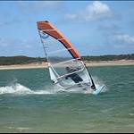
Hi all - I ventured down to Sandy Point (Shallow Inlet) the other weekend and had an awesome sail. Despite forecast being poor and nearby real time wind readings low, the wind was excellent (Easterly) at Shallow Inlet. I'd like to go again, but being based in Melbourne, I'd like to have a reasonable chance of wind before committing to the drive.... so just wondering what resources/indicators people use to predict wind say 2-3 days ahead at Sandy Point?
And does it still work in Westerly conditions - seen forum posts about the dunes building up :(
To decide if it's worthwhile I usually take an average of the forecast from:
BOM Central Coast
www.windguru.cz/15753
and
www.willyweather.com.au/graphs.html?graph=outlook:5,location:13127,series=order:0,id:sunrisesunset,type:forecast,series=order:1,id:temperature,type:forecast,series=order:2,id:temperature,type:observational,series=order:3,id:rainfallprobability,type:forecast,series=order:4,id:wind,type:forecast,series=order:5,id:tides,type:forecast
The latter gives me a lot of individual information (ie rain and tide)
I then check the Yanakie indicator before I leave if it's anywhere as expected. The Wilsons Prom indicator is way too optimistic, in particular in W directions.
Recently the E bank has a lot of shallow spots in particular at low tide and in light wind (= long fin)
Westerly is not ideal IMO, I reckon best for the strip is WSW and SW, but as you pointed out the first section is very gusty due to the dunes building up.
The PIT Crew guys may have some more magic to share ![]()
I use all the weather models and pick the forecast that I like ![]()
![]()
Windguru is reasonable good.
Two spots work in westerly,s, Sandy Point B which is down at the entrance. Experienced sailors only!!!!! and is only good on an outgoing tide. Break anything at the mouth and your a k out in a very short time and in a heap of trouble.
The second spot is the Yanakie channel, sail nth of the car park, can be 10kts stronger up there but nice flat water. Sailed up there on Sunday
As Kato said!
I would add:
Easterlies to NE are excellent fun, especially for the few hours around low tide. If there is any sort of East or NE gradient in the summer months it is usually bound to increase during the day with the seabreeze effect and gets funnelled through Sandy quite a bit more than anywhere else.
The BOM's Yanakie wind station is an excellent guide to easterly wind strength over the inlet and not too bad in West or SW. The Prom is often reading not much more in East but very much more in WSW and West.
windguru for Sandy Point is pretty good and so is PredictWind. The BOM's Meteye is also pretty accurate, especially a day or two out.
Best general blasting angle for the speed strip is SW. Best speed sailing angle is around WSW.
I find Met Eye to be really good too.
As said above, take average between wind guru, willy weather, and Met Eye and you will get a very accurate forecast.
www.bom.gov.au/australia/meteye/