Dunno about an astro theory, but mare's tails preceed a SE blow by 3-4 days, so we are bang on for Saturday.
They were super-reliable at Elliott Heads.
Plus they are just plain pretty !!!
nice one ken, good to learn something new..... ![]()
i found htis on wiki prompted by your post. in future i'll be looking for mares tails.
The random, isolated cirrus cloud does not have any particular significance. A cirrus castellanus cloud indicates that there is instability at the cirrus level.[23] However, a large number of cirrus clouds may be a sign of an approaching frontal system or upper air disturbance. This usually signals a change in weather in the near future, usually becoming increasingly stormy.[24] When the cirrus clouds deepen and spread, especially when they are of the cirrus radiatus or cirrus fibratus forms, this usually indicates an approaching weather front. When the weather front is a warm front, the cirrus clouds spread out into cirrostratus clouds, which then thicken and lower into altocumulus and altostratus clouds. The next set of clouds are the rain-laden nimbostratus clouds.[23][4][25] When cirrus clouds precede a cold front, it is because they are blown off the anvil, and the next clouds to arrive are the thunderstorm clouds, cumulonimbus.[25] Kelvin-Helmholtz waves indicate extreme wind shear at high levels.[23] Within the tropics, 36 hours prior to the center passage of a tropical cyclone, a veil of white cirrus clouds approaches from the direction of the cyclone.[26]
In the mid to late 1800s, forecasters used these cirrus veils to predict the arrival of hurricanes. In the early 1870s, the president of Belen College (located in Havana, Cuba), Benito Vines, developed the first hurricane forecasting system, and he mainly used the motion of these clouds in formulating his predictions.[27] He would observe the clouds hourly from 4:00 AM to 10:00 PM. After accumulating enough information, Vines began accurately predicting the paths of hurricanes, and he eventually published his book, Apuntes Relativos a los Huracanes de las Antilles.[28]
I'm surprised you guys did not know about mare's tails.
The resident old bloke at EH told me about them years ago, and everyone there used to look for them. I have not noticed them as much down here at the GC, possibly because it never bloody blows SE, or because there is so often too much other overlying cloud. I also wondered if we are so much closer to the Bight where the highs are, that they did not form as much.
Either way, few things gladden my heart like mare's tails in autumn.
The sweet cool wind that comes off those systems is like no other.
Are they "cirrus fibratus" ?
The other cloud sign we used a lot was "small puffy clouds on the horizon".
That always meant, "no wind for you", no matter how much optimism or other hints there may be.
Puffy clouds = do summat else.
"Mares tails and Mackerel skies: Storms in a day or two".
I've used this for years, seems pretty reliable.
(watches google searches for "mackerel skies" go through the roof) ![]()
Tx for that.
I had a vague feeling there was a rhyme to go with it, but could not remember it.
I'd forgotten about mackerel skies. There was always good surf on days with a mackerel sky, and again, it's one of those wonderfullly beautiful things to see.
I thought the rhyme was fish scales and horses tails? and that meant some sort of change was coming?
I did notice some of these clouds a few weeks ago in Caloundra a few days before we got the big SE blow up at Burrum.
Quick google search and I found this rhyme
Mackerel scales and mare's tails, make lofty ships carry low sails.
im thinking we'll see wind also. can'r help but fell this is because i ordered a 10' sailable sup!!!!!! ![]()
busy weekend for me, netball in the morning, VP in the arvo and single malt in the evening.
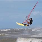
you should skip EH and drop into burrum with your speed gear. if it's high tide take the wave board across to the left handers at woodgate.
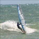
Burrum would be nice, but I don't really have dedicated speed gear, and there is nowhere we can stay with our dog.
There is a nice dog-friendly cottage at EH we have booked, and we are going to look at some land while we are there too.
I'll go quick enough on the speed bank at EH.