The GW-52 just r
ecords data. When you download it into a GPS analysis program (GPS-Results, RealSpeed, GPSAR-Pro etc) you can see the data in any units you choose.
Do you mean you want the
display to give you your speeds in Knots and your distance in KM?
The display Genie rotates the last run top speed and Average speed with the distance travelled. I have the display units set to Knots, but now I think about it, I can't remember if the distance is displayed in Knots or KM with my setting.
Easy to get a rough idea by just doubling Knots to get KM. (It is actually 1Kt = 1.85KM)
Since you prompted me I have just gone to the Locosys website again and found it has been updated with a lot of GW-52 stuff.
 www.locosystech.com/en/product/gps-handheld-data-logger-gw-52.html
You will find the downloads tab at the top of the page.
Here is an interesting note in the FAQ written, I assume, by Dr. Tom Chalko about how to get best accuracy from the device:
Q:Q1: How to improve the accuracy of GW52 speed measurement?
A:Our main suggestion is to use GW52 in direct view of all satellites above horizon. This is a basic requirement for accuracy.
GW52 is a GPS-Doppler instrument optimized to measure SPEED (the magnitude of velocity vector).
The Doppler frequency shift df of each satellite carrier frequency (which GW52 measures and determines speed from) is df=velocity*cos(alpha)/c, where c is speed of light.
As you can see, the measurement of velocity relies on alpha: the angle between measured velocity vector and the direction to the satellite.
When satellite is in direct view, everything is fine: all alpha angles are well defined and the system has good accuracy.
When direct view of some of the satellites is blocked by gps-frequency attenuating objects, such as human body for example, the signal reaching GW52 antenna from these blocked satellites is a result of reflections, refractions, diffraction and all the interferences between them. What is the alpha angle that the signal comes from? Who knows?
This ambiguity in direction of GPS-Doppler signal is one of the main sources of speed errors.
Direct view of all gps satellites above horizon is required due to the physics of Doppler Effect.
The actual accuracy of GW52 depends on satellite distribution above the horizon in relation to measured velocity vector, but 1.3 cm/s accuracy (3sigma) in measuring 10s-average speeds above 100km/h have been observed.
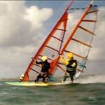
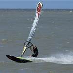
To achieve comparable speed measuring precision in sport, GW52 must be worn on top of the helmet. All other locations on the body simply ruin the speed measurement accuracy.
In Practice, it does make a significant difference to wear the GPS on the top of your head.
The first and most important reason is clearly given above.
The second important reason is that you head is very stable while you sail compared with other possible body locations. This dramatically reduces high speed frequency movements (vibrations) that can also badly affect accuracy.
Mount you GPS on the top of your helmet! Many ways to do this easily, but you can also put it inside the foam lining with the antenna facing the sky. The fibreglass/plastic of the helmet shell does not block the radio waves.This is how I do it:
web.archive.org/web/20111210232653/http://mtbest.net/speed_sailing_helmet.htmlWhile at a recent ski trade show, I checked out all the skiing and snowboard helmets and found that most of them were quite suitable to use in this way. Don't worry about the cloth linings in water use, they are fine.