Our waves are little. Sometimes they are bigger with longer period if there's a cyclone goes past the Kimberley or pass north of us. Most of the time they are from more persistent winds.
We are at the red dot (Casuarina Beach, Darwin). The beach faces pretty much directly north-west. It is about 60 km directly north to the islands. And there are other islands in the gap.

There is mostly only ever small cross chop/wind chop that comes from the north-NW. The only swell that gets in can surely only come from the west.
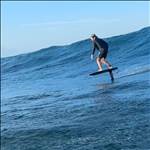
As in the above pic, this arvo the winds are mostly offshore south-easterly. It has been for a good few days. Even swinging to a more humid north-easterly.
This arvo there was the usual northerly cross chop, but also some longer period (small) waves coming from the west.
Now, that swell surely is not coming all the way in from some system in the Indian Ocean and pushing all that way in across those shallow waters against those prevailing easterly winds (correct me if possible?)
So, could they be from the easterly winds to the north of the islands, and refracting almost 180degrees into us?

Any swell prediction gurus out there?
Select to expand quotehilly said..
Try Windy swell view
 Select to expand quotefinsup said..
Our waves are little. Sometimes they are bigger with longer period if there's a cyclone goes past the Kimberley or pass north of us. Most of the time they are from more persistent winds.
We are at the red dot (Casuarina Beach, Darwin). The beach faces pretty much directly north-west. It is about 60 km directly north to the islands. And there are other islands in the gap.
There is mostly only ever small cross chop/wind chop that comes from the north-NW. The only swell that gets in can surely only come from the west.
As in the above pic, this arvo the winds are mostly offshore south-easterly. It has been for a good few days. Even swinging to a more humid north-easterly.
This arvo there was the usual northerly cross chop, but also some longer period (small) waves coming from the west.
Now, that swell surely is not coming all the way in from some system in the Indian Ocean and pushing all that way in across those shallow waters against those prevailing easterly winds (correct me if possible?)
So, could they be from the easterly winds to the north of the islands, and refracting almost 180degrees into us?
Any swell prediction gurus out there?
What about the crocs?
Select to expand quotehilly said..
Try Windy swell view
... yeah but that doesn't explain the longer period sets coming from the west?
Select to expand quotemediumbilly said..hilly said..
Try Windy swell view
finsup said..
Our waves are little. Sometimes they are bigger with longer period if there's a cyclone goes past the Kimberley or pass north of us. Most of the time they are from more persistent winds.
We are at the red dot (Casuarina Beach, Darwin). The beach faces pretty much directly north-west. It is about 60 km directly north to the islands. And there are other islands in the gap.
There is mostly only ever small cross chop/wind chop that comes from the north-NW. The only swell that gets in can surely only come from the west.
As in the above pic, this arvo the winds are mostly offshore south-easterly. It has been for a good few days. Even swinging to a more humid north-easterly.
This arvo there was the usual northerly cross chop, but also some longer period (small) waves coming from the west.
Now, that swell surely is not coming all the way in from some system in the Indian Ocean and pushing all that way in across those shallow waters against those prevailing easterly winds (correct me if possible?)
So, could they be from the easterly winds to the north of the islands, and refracting almost 180degrees into us?
Any swell prediction gurus out there?
What about the crocs?
.. the only waves from them are our bow waves getting out of the water!
Select to expand quotefinsup said..
... yeah but that doesn't explain the longer period sets coming from the west?
In Windy, check the "Swell2" sub-menu item to see secondary swells.
MSW even shows secondary and tertiary swells. Here is the forecast for Mindy Beach today:
magicseaweed.com/Mindil-Beach-Surf-Report/5169/#
You can see that at 3pm there are swells coming from opposite directions.
Thanks Colas.. ah yes so it looks like the longer period secondary stuff is actually from further to the west. That is what we want to keep an eye on ??
But note that those two apps confuse first/primary, and second swells.
Windy.

MSW.

By the way, was clean westerly sets this arvo w no cross chop ![]()
..this is interesting.
Can change the animation to 'waves' on earth.nullschool.net.

... and it shows a big front of 12 second swell reaching up from the SW...

... even though prevailing winds are all still Easterly.

Have to keep an eye on that... How long would would it take that swell that's hitting Margs to get this far? if at all...
Select to expand quotefinsup said..
..this is interesting.
Have to keep an eye on that... How long would would it take that swell that's hitting Margs to get this far? if at all...
Hmmm, that's very interesting Finz!
so, are the charts suggesting that some of the swell that's been bombing Margarets the last few days for the comp could possibly make its way up the west coast and bounce its way into the north coast (albeit a considerable fraction of the size)?
And if so, when's it farkn get here???![]()
I don't know Mangy.
if you scroll thu the timeslider here;
magicseaweed.com/Indonesia-Surf-Chart/44/?type=period&spot_id=4106&start=2021-05-02&end=2021-05-09×tamp=1619967600
It looks like there's definitely a westerly limit to the reach of the swell. Pretty much in line with Rote Is (southern most point of Indo).
Which make sense if you look at the bathymetry.

But something does get through, coz we do get something!
Just a matter of how long it takes, and what's left.
... and a neap tide lining up with Saturday morning...