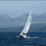
Just some observations of BOM Forecasting after spending 3 weeks making weather decisions on a passage from Hobart to Brisbane.
So checking forecasts against coastal observations against webcams every few hours for 3 weeks.
Might be right but might be wrong but here is what will inform my decision making in future.
I should say the trip was completed with no overnight passages.
BOM forecast is for the worst weather to be experienced in a forecast area but forecast areas are very large areas ie Illawarra is Ulladulla to Port Hacking and 100 miles seaward. (So almost 10 000 square miles)
So you have too look more local on a coastal passage.
To this extent common apps such as Windy are much more helpful (Meteye is crap due to lack of definition)
Local observations are much more useful and the webcams are particular useful to see what its behind and ahead and of course sea state.
Particularly when the weather systems are going West to East and not North to south.
On 5 days between Lakes and Entrance and Port Macquarie the boat left in BOM Gale Warnings.
The boat moved everyday from Lakes Entrance to Southport even if it was 50 miles.
Ulladulla to Shell Harbour was done before the forecast gale came in notwithstanding the gale warning was in force from earlier.
Some insurance policies do not allow this.
While fresh but less than 25 knots , there was plenty of west in the direction and no significant sea state even in Stockton Bight.
Surf Cams at various beaches (now very numerous) were very helpful to gauge this.
So overall, can't help thinking the BOM is over-egging it to the extent that the forecasts are not that
useful anymore.
Examination of what is happening from local sources are much more useful on a coastal passage.
Be helpful if for small ships the BOM produced a coastal water forecast to say 15 miles out and put the rest in an extended High seas forecast.
Given that with the exception of Tasmania, almost all forecasts of computer generated even to the extent of the voice message, it would not seem that much extra work or cost.
My 20 cents!
Thanks for that.
Did you have a "favourite" forecast model for Windy that you found was more accurate for east coast??
Did you have phone/internet coverage all the way??
Select to expand quoteLazzz said..
Thanks for that.
Did you have a "favourite" forecast model for Windy that you found was more accurate for east coast??
Did you have phone/internet coverage all the way??
Can only speak for Telstra, but good coverage even across the strait if you go up the western side of Flinders Island.
As for Windy, even that has 3 options which reflect the main weather models publicly available in the world.
More a question of which model works in your area rather than anyone particular app.
For instance the NOAA model over estimates in the north Tasman sea and it does not matter if you are using windy, Weatherzone (also good) or Predict wind, the trick is to understand the data each is relying on.
All pretty consistent though particularly in southern Australia.
On our trips I have still found Meteye to be really useful. I think that Windy gives the impression of better detail but nice computer graphics may obscure the fact that the model is imperfect.
I find Meteye to be really useful when dealing with land effects, much better than Windy. The BOM have really nice models about how the land influences wind.
On our trip back from Hobart (crossing Bass Strait from Flinders) we waited till both Meteye and Windy were saying the same thing. The crossing went well. On a trip from Jervis to Sydney, like Lydia, I left with a gale warning imminent, but because of Meteye's great detail and coastal effects plotting I went anyway. I was ready for the 40 knots when it came in and was reasonably safe.
Meteye showed there to be only about 12-15 knots in Sydney Harbour. I was 2 miles offshore where Meteye was red and it was blowing like stink. Then I came in through the heads with only a scrap of genoa out and had to unfurl it fully and even motor to get out of the way of a ferry. Meteye was absolutely spot on for the land effects, same in the d'Entrecastraeu channel - fluky winds were well forecast.
Windy gives me a much better picture of the large scale, showing isobars and pressure on top of the wind. It is a super visualisation tool. I like the idea of webcams, especially when crossing bars on the NSW coast, but Meteye is probably my top pick for coastal sailing.
I am old enough to remember the old radio broadcasts - we have come such a massively long way since then and can make trips knowing such fine detail about the winds and how they will change. The forecasts today are so incredibly useful, that going back would be like going to the stone age but they still can be wrong. They are so much better, but not infallible.
I like buoyweather.com. I think it's from the USA but they seem to know more than BOM!
Select to expand quoteKankama said..
On our trips I have still found Meteye to be really useful. I think that Windy gives the impression of better detail but nice computer graphics may obscure the fact that the model is imperfect.
I find Meteye to be really useful when dealing with land effects, much better than Windy. The BOM have really nice models about how the land influences wind.
On our trip back from Hobart (crossing Bass Strait from Flinders) we waited till both Meteye and Windy were saying the same thing. The crossing went well. On a trip from Jervis to Sydney, like Lydia, I left with a gale warning imminent, but because of Meteye's great detail and coastal effects plotting I went anyway. I was ready for the 40 knots when it came in and was reasonably safe.
Meteye showed there to be only about 12-15 knots in Sydney Harbour. I was 2 miles offshore where Meteye was red and it was blowing like stink. Then I came in through the heads with only a scrap of genoa out and had to unfurl it fully and even motor to get out of the way of a ferry. Meteye was absolutely spot on for the land effects, same in the d'Entrecastraeu channel - fluky winds were well forecast.
Windy gives me a much better picture of the large scale, showing isobars and pressure on top of the wind. It is a super visualisation tool. I like the idea of webcams, especially when crossing bars on the NSW coast, but Meteye is probably my top pick for coastal sailing.
I am old enough to remember the old radio broadcasts - we have come such a massively long way since then and can make trips knowing such fine detail about the winds and how they will change. The forecasts today are so incredibly useful, that going back would be like going to the stone age but they still can be wrong. They are so much better, but not infallible.
Fair comments, I actually think Meteye was better a while ago as have been disappoint lately but at the end of the day all of the apps a can only be based on 4 models. Each interpret each the models differently.
Interesting what you say about land effects as none of the apps do well north of 1770 on the Qld coast with land breezes especially.
I have to agree with the overall point that BOM seem to over-forecast, but I do find MetEye usefull when used alongside Windy etc. I especially like to use the AusWinds app (used to be Hobart Winds) in conjunction with them, because it aggregates all the real time data from every Automatic Weather Station in Australia. In addition, as soon as you drill into a graph on one of the AWS reports, it has the forecast trend in a lighter tone. I find it super handy to have such a dense set of data visually represented in virtual real time.
BOM were heavily criticised after the '98 Hobart disaster. I had to look it up again to remind myself propery, but I think they put in place some much broader forecasting after the coroner directed them to add maximum gusts and wave heights to forecasts. So the end result is often such a big range that I have to compare them against other models to make sense of them. I also find that since all the forecasting moved to the mainland a few years back, the Tas forecasts seem less accurate. Have any other Tas people noticed that?