toppleover said...
Hey Marv, just interested to know if you guys are evacuating or if not what precautions/preparations you are undertaking, keep safe and all the best.
Top
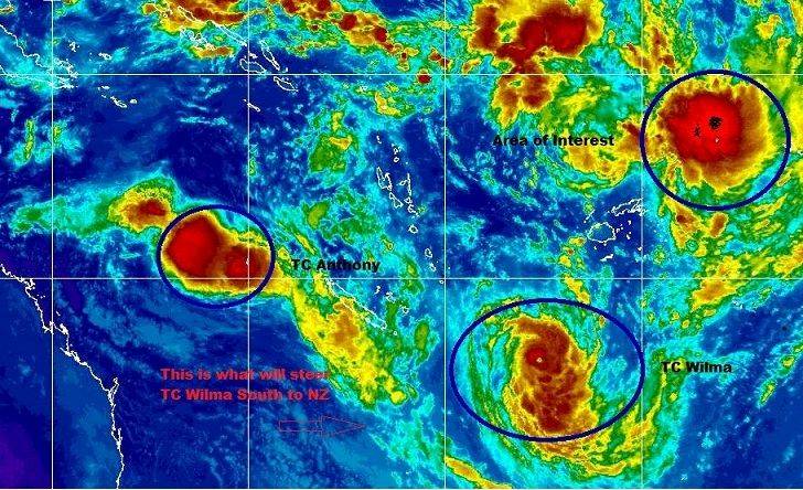
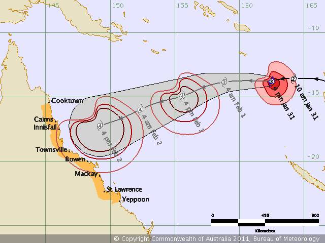
Im afraid it could be the worst Cyclone Australia has ever had!
To be honest we really hope for a wonder, this system is big, fast and the perfect conditions are given to be a Cat 5, covering a huge area of North Queensland.