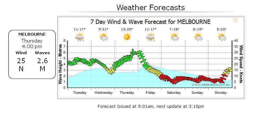
For me, both involve a fair bit of internal "munging" to get a good idea of whether the wind will happen...
For example, if there's a big spike northerly that then swings southerly, I know it's not going to be nearly as big as the graphs show. So just by looking at the graph above I've got a fair idea that Thursday arvo won't be nearly as good as the raw graphs suggest.
But if there's a good sized pulse over a couple of days then you know it's going to be pretty close to the mark.
Of course it all depends on your local spots, local conditions, in the end you're the only one who knows how to munge your graphs to get some meaningful forecasts