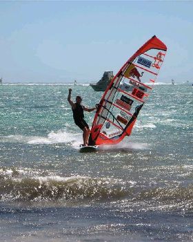
hope everyone stays safe in fnq. looks like a real nasty one on your doorstep. bom's latest has it at cat4 and possible intensifying as it moves towards the coast. will be interesting to watch.
longer term models are guessing for it to head back out into the coral sea and do a coast run as a low washing out near hervey bay aka burrum heads around Wednesday next week.
IDQ20023
Australian Government Bureau of Meteorology
Queensland
Tropical Cyclone Warning Centre
Media: The Standard Emergency Warning Signal should NOT be used with this
warning.
TOP PRIORITY FOR IMMEDIATE BROADCAST
TROPICAL CYCLONE ADVICE NUMBER 8
Issued at 1:54 pm EST on Thursday 10 April 2014
A Cyclone WARNING is current for coastal areas from Cape Grenville to Port
Douglas, and inland to areas including Laura.
A Cyclone WATCH is current for coastal areas from Port Douglas to Innisfail,
and inland to areas including Kalinga, Palmerville, and Chillagoe.
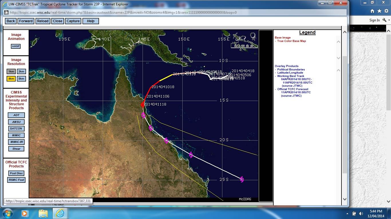
At 1:00 pm EST Severe Tropical Cyclone Ita, Category 4, was estimated to be
420 kilometres northeast of Cooktown and
380 kilometres east northeast of Cape Melville, and
moving southwest at 16 kilometres per hour.
SEVERE TROPICAL CYCLONE ITA, CATEGORY 4, is expected to move in a general
southwest direction towards the far north Queensland coast today and into
Friday, while possibly intensifying further.
Severe Tropical Cyclone Ita poses a significant threat to communities along the
far north Queensland coast and at this stage it is expected to approach the
coast between Cape Sidmouth and Cape Tribulation and make landfall late on
Friday as a SEVERE CATEGORY 4 TROPICAL CYCLONE with VERY DESTRUCTIVE WINDS near
the core and GALES extending some distance from the landfall location.
DESTRUCTIVE WINDS currently extend 80 kilometres out from the centre and may
develop between Cape Sidmouth and Cooktown from as early as Friday morning
before extending inland to Laura and further south to Cape Tribulation later in
the day.
GALES extend 190 kilometres out from the centre and may develop between Cape
Grenville and Cape Tribulation from as early as late tonight before possibly
extending further south to Innisfail and inland to Kalinga, Palmerville, Laura,
and Chillagoe during the day as the system moves closer to the coast and over
land.
Coastal residents between Cape Sidmouth and Cape Tribulation are specifically
warned of the dangerous storm tide as the cyclone crosses the coast late
Friday. The sea is likely to rise steadily up to a level which will be
significantly above the normal tide, with damaging waves, strong currents and
flooding of low-lying areas extending some way inland. People living in areas
likely to be affected by this flooding should take measures to protect their
property as much as possible and be prepared to follow instructions regarding
evacuation of the area if advised to do so by the authorities.
Very heavy rain, which may lead to flash flooding, is expected to develop about
parts of the Peninsula and North Tropical Coast and Tablelands districts late
today and persist into the weekend.
Details of Severe Tropical Cyclone Ita at 1:00 pm EST:
.Centre located near...... 12.4 degrees South 147.5 degrees East
.Location accuracy........ within 15 kilometres
.Recent movement.......... towards the southwest at 16 kilometres per hour
.Wind gusts near centre... 260 kilometres per hour
.Severity category........ 4
.Central pressure......... 948 hectoPascals
The next advice will be issued by 5:00 pm EST Thursday 10 April.
This warning is also available through TV and Radio Broadcasts; the Bureau's
website at www.bom.gov.au or call 1300 659 212. The Bureau and the State
Emergency Service would appreciate this warning being broadcast regularly.
A map showing the track of the cyclone is available at:
www.bom.gov.au/cyclone/