Willyweather Tides
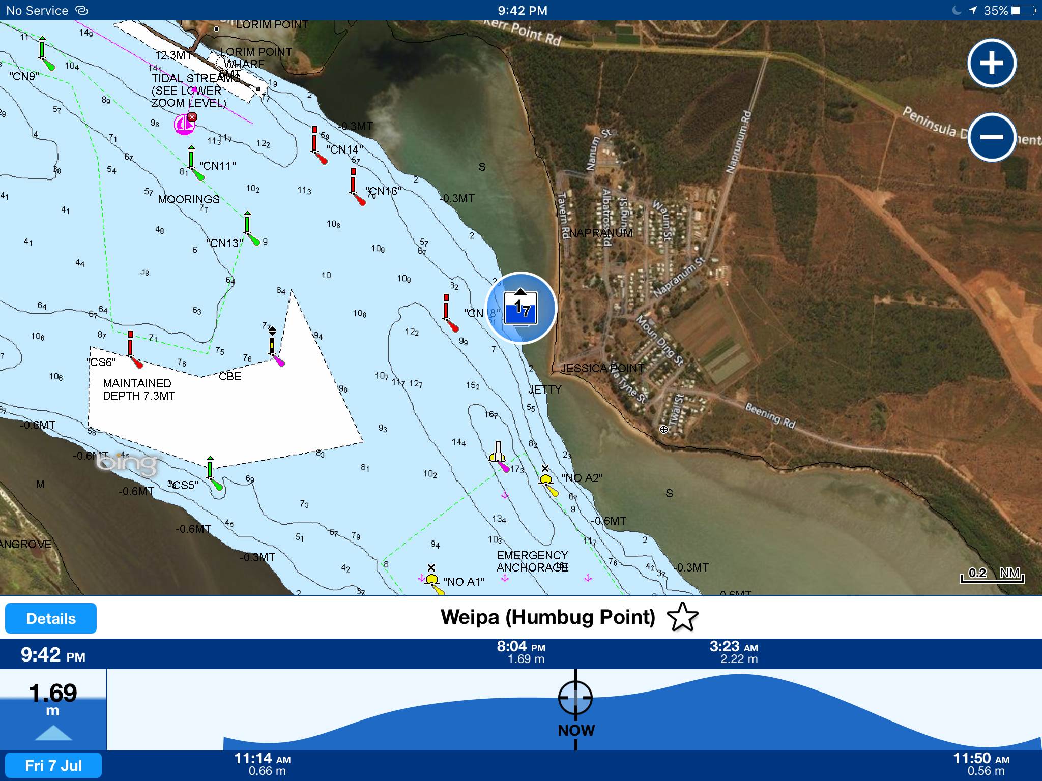
I occasionally check the tide on Willyweather. Yesterday, we needed to be precise so did the full Standard port, secondary port & tidal curve calc. Noticed that whilst WW was spot on with the time , the height was way out (WW was set to the closest secondary port location)
Have since confirmed with WW that, whatever the location, they just show the nearest Standard Port - which could be way out, especially if the nearest Standard Port is not the correct one for the relevant Secondary Port - as happens here in the south of the Great sandy strait.
Anyway, I never use WW tides for more than a casual glance, but thought it might be of interest.
Cheers
.Bristle
View topic