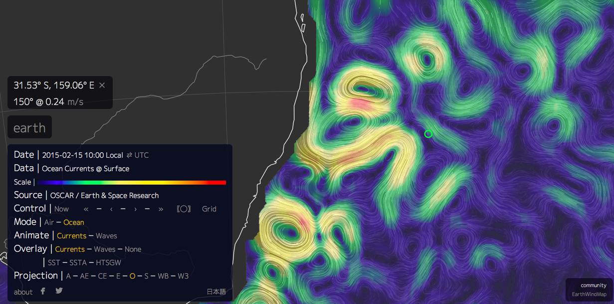
On a recent trip to Lord Howe Island from Southport we were aware of the Ocean Currents by comparing speed across the water (log) and what the GPS was indicating but it very radical and I was wondering if I was interpreting the information correctly. I have only ever used this link for looking at the "Winds of the World" but when I set it to show "Ocean Surface Current" it pretty well explains the variations in the direction of the current we experienced during our trip. I placed a green circle where Lord Howe Island is.
Previously I had only viewed
oceancurrent.imos.org.aufor finding out what the current was up to. But the animated web page below paints a better picture. (for me

)
earth.nullschool.net/#current/ocean/surface/currents/orthographic=-206.08,-32.77,3000