I don't know for sure, but I am guessing that most of the people who frequent this forum are pretty focused on weather forecasts.

I certainly am, and friends of mine have sometimes commented that my life is totally ruled by weather forecasts.

Well, they are correct!

Everything I enjoy doing the most these days, windsurfing, surfing, skiing and even motorcycle riding, is totally ruled by weather conditions.
Because if this, I have become very focused on weather forecasting and forecasts.
A lot of unkind things are said about the (lack of) accuracy of weather forecasting. But how justified are they?
This started me off on a journey exploring weather models and their applications, and as Fangy says, if you are having trouble getting to sleep at night, read on!
I came across this blog today that is worth a look:
blogs.agu.org/wildwildscience/2015/07/06/weather-by-icon-is-a-bad-way-to-get-an-accurate-forecast/Not only does it address this very topic of why we may have a misconception about the accuracy of weather forecasts, but it uses a study from Melbourne to illustrate the point.
Here is a quote from the blog:
A recent paper published in the Quarterly Journal of the Royal Meteorological Society looked at forecasts for Melbourne Australia, both by numerical weather model and by forecasts produced for the public. This is from the Abstract:The accuracy of the current official Day 5-7 forecasts is found to be similar to that of Day-1 forecasts from 50 years ago. The accuracy of experimental Day 8-10 forecasts is comparable to that of the Day 5-7 forecasts, when they were first officially provided 15 years ago. Some overall skill*, albeit limited, is evident out to Day-14 and significance testing indicates that it is unlikely that this apparent skill arose by chance.
*(Note by me: "Skill" is the term meteorologists use to describe the accuracy of forecasts based on comparing the forecasts with what actually happened.)
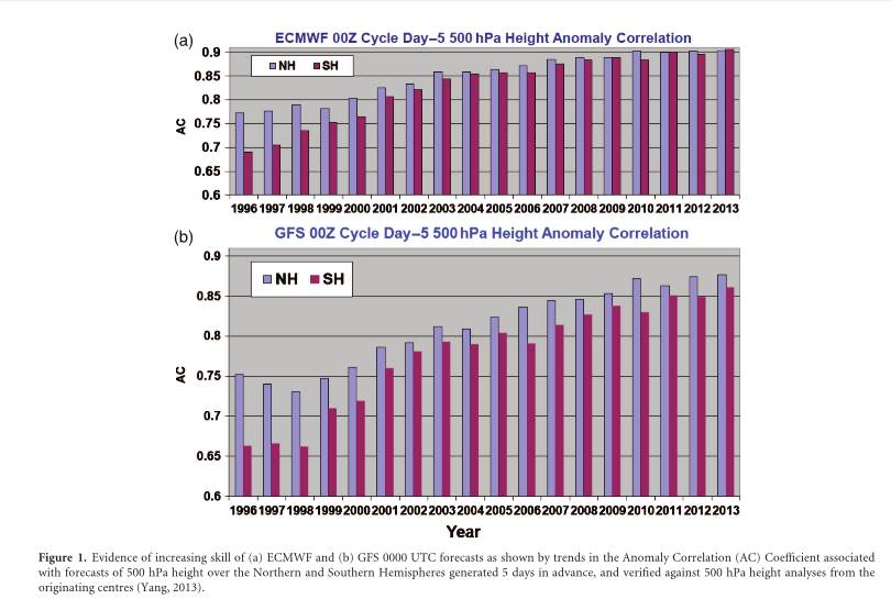
This illustrates a couple of interesting things:
Firstly, there has clearly been a very big improvement in the accuracy of forecasts over the 18 years illustrated. He attributes this thus:
quote:
"much of the increasing skill is due to faster supercomputers and more sophisticated numerical weather prediction models. "
Secondly, of special interest to us is the difference between the accuracy for the Northern Hemisphere (NS) and Southern Hemisphere (SH) for the two models illustrated. (exaggerated by the difference in scale of the two graphs - poor illustration practice - but the difference is still there).
Note that this illustration suggests that forecasts for the Northern Hemisphere were generally slightly better in the past, and still are for the GFS model. For the ECMWF model, the difference seems now to be negligible. He goes on to say: "
Globally the best weather model continues to be the European Centre for Medium Range Weather Forecasting's ECMWF model which has on average substantially better skill than NOAA's Global Forecast System (GFS) model."
This is a of particular interest to me as the GFS forecasts is the one used in the main Windguru tables for in Australia (Other models with higher resolution are used in some parts of the world - see:
old.windguru.cz/int/help_index.php?sec=models). I have been subscribing to the Predictwind forecasts (
www.predictwind.com) for a few years now and they provide both GFS and ECMWF in their tables (They used to provide GFS and CMC). My feeling is that the ECMWF wind forecasts seem to get it closer more often in the locations that I am interested in. I am not so sure about the proprietary PWE and PWG forecasts, which often seem to predict stronger winds than we actually get.
I also refer regularly to the BoM's MetEye local forcasts and find them very useful.
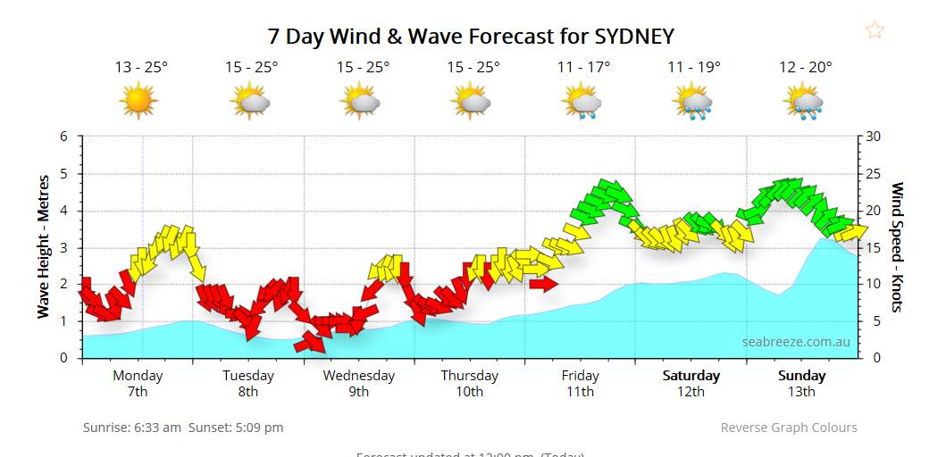
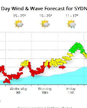
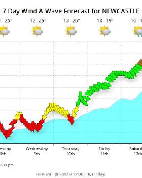
www.bom.gov.au/australia/meteye/But of course, the main point he makes is that the short term accuracy is a lot higher and than longer term and this has improved substantially in recent years. All the models do very well for the 2-3 days ahead, but after that they can drop off quickly. We see that all the time just by observing Windguru forecasts. Things that appear, and look great 7 or 8 days out, often change substantially until the last few days. Forecasts for 24 to 48 hrs ahead are usually very close to what happens. Likewise, in tables that include multiple models side by side, like the Predictwind model, we can see that they often all agree pretty closely in the short term but can diverge markedly more than 4 or 5 days out.
There are quite a few
global numerical weather prediction models available to weather forecasters and the public.
The main ones of interest in Australia are:
-Global Forecasting system (GFS) USA based. 8 day higher resolution model and 16 day lower resolution models
-European Centre for Medium-range Weather Forecasts (ECMWF) Short term high res. and longer term low res. models
- BoM run their own models (ACCESS-R and ACESS G - they are a short term 3 day high resolution model and a longer term 10 day, lower resolution model)
There are many others, some are based on one or more of the other models and are often modified for local conditions or to focus on specific weather aspects. For example: The GPS forecast is one of the few covering Australia that can forecast snow levels and snowfall. Weatherzone (
www.weatherzone.com.au) offer a number of models shown as forecast weather charts including those already mentioned, but also:
-TWC-7day, "TWC Meteocast is based on the WRF (The Weather Research and Forecasting model), and tuned for Australian conditions, and
-CMC -6day, "The global implementation of the Global Environmental Multiscale (GEM) model run by Environment Canada, run twice daily at high resolution out to +144 hours."
But the best data for Australia usually comes from the local BoM models. This is of course, from a model that is specifically designed and tuned for this part of the world and usually calculated at higher resolution.
Many organisations a businesses produce specific detailed data in a graphical or visual format for specialised uses that is based on various model data. (Eg, Windguru/Predictwind/Seabreeze/Willy Weather/Bouyweather/FishRanger etc)
Some of these providers can provide a more focused forecast for specific things. According to the Fishranger website,(
www.fishranger.com.au). these
can actually be more accurate (higher resolution) than the BoM's own MetEye forecasts from whom the data is souced, which use data with a 6km resolution, whereas Fishranger can actually use data with a 3km resolution in Vic, and Tas, sourced from BoM,
www.bom.gov.au/weather-services/about/forecasts/australian-digital-forecast-database.shtmlbut many use the GFS or ECMWF models which are less focused on Australia and have lower resolution.
This page gives some interesting insight into some popular weather data apps and websites. Yes, it is pushing their own product, but I think it is good insight anyhow, with many popular forecast apps and their sources listed, including Seabreeze:
www.fishranger.com.au/the_truth_about_weather_sites